Wednesday, October 29, 2008

A Month Late

We got Bill off to the airport early on Friday morning to fly to Lima, and then Atlanta, and had just a few hours to kill until our trip to Lima -- by bus.

We had tried to get Bill to come with us by bus -- it´s a third of the price of flying -- but he took one look at the 19-hour travel time and said no way.

Our bus left at 2 p.m. and was scheduled to arrive in Lima about 9 the next morning. We were traveling with a company called Cruz del Sur. Normally we give hardly any thought at all to what bus company we travel with but of the number of things complicating life for travelers in Peru is bus travel and personal safety. One issue, which we can do nothing about, is hijackings, which have occured but which we have heard little about recently. The other problem is theft on busses. Cheap busses tend to stop constantly, and since many longhaul busses here travel at night it´s much easier to get stuff stolen on a bus which is stopping all the time since there are that many more people getting on and off. The better bus companies pick passengers up at one end and hardly stop at all until they get to the other. Cheaper bus companies are also more likely to have drunk drivers, bad drivers and no onboard attendant -- not that I need to be served, but the presence of an attendant can help deter theft between passengers.

The bus climbed out of Cuzco and began to traipse across the staggering Peruvian topography. It´s 18,000 foot glacier clad mountains, ridiculously steep mountains, and bottomless valleys. The road constantly climbed to 11,000 or 12,000 feet to cross a pass then descended just as quickly to 6,000 feet to cross a river. I woke up at one point in the night finding it hard to breathe. I looked at my altimeter and found we were over 14,500 feet. I let my watch accumulate vertical feet of descent for the trip and by the time we got to Lima it had tallied up 48,000 total vertical feet.

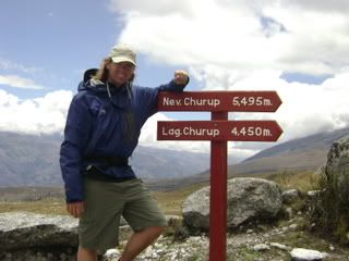
(Trail to Laguna Churup)
Photobucket

Day dawned with us back on the coastal desert -- sand, fog and eerieness. We pulled into Lima late, at about 10:30. Annoyingly, there is no central bus station in Lima. Instead, each company has an office. Ours was along a freeway. Bus stations are grimy, but convenient since you can go from company to company and see who is going where when. Instead, we bought a ticket for the next day to Huaraz and wound up with an unexpected day in one of the world´s largest cities.

It was not a day we wanted to have. We´re running short of time and still have a few countries to go before we fly out of Quito on Nov. 15. Besides, Lima at first glance was not what you´d call fun.

We took a taxi to the nicest part of town and checked into what our Lonely Planet guidebook recommended as a ´splurge.´The Hostal del Patio was in the city´s best neighborhood and close to the coast, but like so many other things about Lonely Planet I take exception to its recommendation. Lonely Planet´s idea of a great hotel is one with large rooms, attentive personalized service and, inevitably, flower draped patios and courtyards. This had all that and, for $48 a night, no hot water and moldy mattresses. We ate at a posh sidewalk cafe, walked through a fancy outdoor mall set on a cliff over the ocean, and watched hang gliders take off from a bluff over the Pacific.

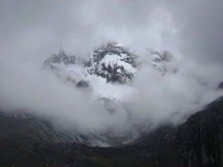
(Nevada Churup, outside of Huaraz, about 17,000 feet high)
Photobucket

We were back at the bus station the next morning. The Cruz del Sur for Huaraz left on time and spent an hour plodding through the endless sprawl of Lima. What looked like a regular old ugly city on the south side morphed into a seriously wretched city on the north side. Laura remarked at one point it did not look all that different from Calcutta, and I had to agree.

Away from town we were back into the vertical world of Peru. We rolled into Huaraz at 5 p.m. after cresting yet another bleak 14,000 foot pass.

Huaraz is the principal city of Peru´s northern Andean region. It was flattened by an earthquake in 1970 and is still in many areas being rebuilt, or so it seems. It´s a drab, ugly city of about 100,000, convenient only for its espresso bars and location next to the fantastic Cordillera Blanca, a line of 19,000 foot mountains, and proximity to several other breathtaking ranges.

Unfortunatly for anything having to do with the mountains and outdoor sports, we got here about a month late. As we have traveled north we have gotten into progressively wetter weather, and here, at 10 degrees south latitude, we are squarely in the wet season. It´s clear but for a brief moment in the morning and then gets cloudy as the morning progresses. There is always rain by 1 p.m. and after that the day is pretty much finished.

We did manage to take one hike in the mountains. We hired a guide, who packed us a lunch and hired our group a taxi, and hiked to Laguna Churup. Yet another of the things complicating life for travlers in Peru is the likelihood of being attacked while hiking. It´s hard to pin down exactly when and where it is the most dangerous, but the bottom line is you can´t go traipsing around in the backcountry on your lonesome. At least Jesus was a nice guide.

We left town at 7:30 as clouds were beginning to build. We drove from town, at 10,000 feet, to the trailhead at 12,200 feet. From there we followed a trail into a narrow canyon and hiked up alongside a waterfall. From there the trail was inches wide, wet, and we were pelted with spray from the waterfall and water falling from the cliffs above. Much of the way was legitimate rock climbing, and Laura took a bad fall and scraped her knees and poked gaping holes in her pants -- the North Face pants that have now been to five continents on her. Laguna Churup was a wash of blue and green at 14,000 feet and ended at a headwall which led up to Nevada Churup, some 17,000 feet tall. We were back in town by 3 p.m. for chocolate cake and the regular afternoon downpour.

New snow on the mountains this morning. We did not feel like doing much but do have a night bus at 9 p.m. for Trujillo. We´re making a B-line for Ecuador. Hope to make it by Saturday.
Friday, October 24, 2008

Machupicchu (or Machu Picchu -- depends)

On Monday we woke up early, walked across downtown, and boarded the very expensive train to Machupicchu (though it´s also commonly spelled Machu Picchu, and occasionally is spelled Macchu Picchu).

When it comes to ruins here in Peru, they run quite the racket and the whoel thing left me with mixed feelings. If you want to see Machupicchu independently, here´s the breakdown:

·backpacker train from Cuzco to Aguas Calientes: $96
·bus from Aguas Calients to Machupicchu and back: $14
·entry to ruins: $42
·cost to use the toilet at park headquarters: 30 cents.

It was the fee to use the toilet, after I had paid $42 to get in, that really left a bad taste in my mouth. But regardless, Machupicchu is likely among the most expensive wonders in the world to visit.

So is it worth it? Hard to say. The ruins themselves are not terribly interesting, in my opinion, especially when compared to some other places I´ve been like Tikal (Guatemala), Copan (Honduras) and Angor Wat (Cambodia). What is not an arguable point, however, is the grandeur of the setting.

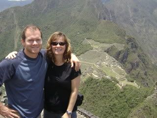
(Here´s Laura and Bill atop Waynapicchu looking down on the ruins:)

Photobucket

The train from Cuzco to Aguas Calientes switchbacks to get out of Cusco and climb up to 11,000 feet before ambling through pastoral valleys and small towns and beginning a descent into a radical canyon. The canyon opens somewhat before closing further and picking up a raging river. The elevation over the course of four hours drops from 11,000 feet to 6,300 feet, along the way are stupendous snowcapped mountains.

We arrived in Aguas Calientes about noon. We had heard a lot of bad things about this town but it turned out to be pretty cool -- totally isolated, no cars, big river running right through town, and some of the most incredible mountains I´ve ever seen.


Photobucket
The hassle factor there was pretty high and we practically got chased out of town by touts wanting us to stay at thier hotels. We chose the one who hassled us the least and set out on a hike.

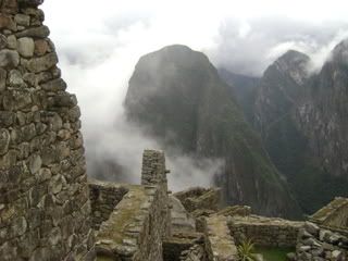
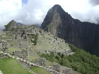
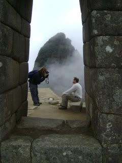
The hike was up a peak facing Machupicchu. This photo, taken from the ruins the next day, shows the mountain. Climbing it involves tackling a long series of wooden ladders and legitimate rock scrambling. It took about 90 minutes to get to the top.

Photobucket

We were up early the next morning to save $14. The tourist bus to the ruins is $7 each way, but you can forgo that by hiking a trail which runs between the road´s endless switchbacks. Laura and I left at 5 a.m. and got to the ruins, sheathed in fog, at about 6:30. Luckily we found Bill. We then got in line to get tickets to climb Waynapicchu, the steep peak that backs the ruins. The climb is free, but they only let up the first 400 who make it to the base. The climb was more ladders, steep rocks, a narrow Inca tunnel and then a scramble to get to the summit.

Waynapicchu in the background:

Photobucket

By 2 p.m. we were pretty wasted. Laura and Bill rode the bus down while I took one short hike, to a place called Temple of the Sun, which has classic views down on the ruins.

On Wednesday we had an easy morning and caught the train partway back to Cuzco, getting off in Ollaytatambo, a small and very pleasant town. When I thought of the ruins in Peru I just thought of a handful of the popular ones, but the whole countryside is filled withe ruin´s; on a two hour trainride we passed a dozen or more, some of which were simple Inca terraces and others of which were teraces matched with walls, trails and forts. Ollaytatambo was no disappointment; not only was it extensive but it was backed by snowcapped peaks. We stayed in a very nice hotel for not a lot of money and had good Mexican food for dinner.

Bill slept quite a bit while he was with us, and I think it drove home something I try and tell people: traveling is not easy. One of the most difficult things is the fact that we never go to the same place twice. That means we never know where the bus station is, where our hotel will be, where is a decent place to eat, what streets are unsafe at night, or a million other things. Also serving to further exhaust the traveler is the fact that in many places a decent night´s rest is pretty hard to come by, beds can be awful, food of negligible nutritious value, hotels noisy, and etc. etc. etc. So it´s hard work, except when it´s easy.

Wednesday night, right during our Mexican dinner, I started to feel pretty lousy. I had been feeling weird on and off for a couple of days but at night my stomach started to cramp and I got the dreaded sulfur burps.

A few years ago, traveling in Vietnam, I got pretty sick -- travelers stuff. The hallmark of the sickness was burps that tasted like sulfur. It´s fairly disgusting. After suffering through this for a while someone mentionned that sulfur burps were a sign of girardiasis. Girardiasis is a parasite that hangs out in polluted water, and even though we filter all the water we drink I suppose you can still ingest some through juices, vegetables and even accidentally in the shower.

The cure for girardiasis is a drug called flagyll. It´s a superstrong antibiotic available without prescription in countries like those where you´re most likely to get it.

I felt pretty awful Wednesday night and most of Thursday, worrying about my sulfur burps, until Laura said we should just get flagyll and not wait for it to get worse. Well, first pharmacy we went to had it for less than a dollar a pill. I took two last night and one this morning and the sulfur burps are gone. Yeah!

Sunday, October 19, 2008

Oh, Cuzco

We arrived in Cuzco last week with me feeling pretty sick. Laura thinks it's all the salsa aji I've been practically drinking lately. It's a fiery green sauce you get with all meals here served in a tiny cup with a wooden spoon that you dabble on to your food. Good times, except for last week, when it was bad times.

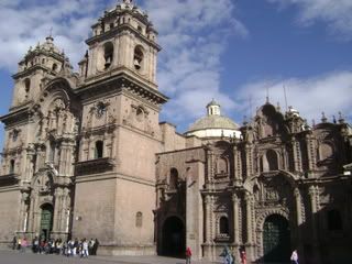
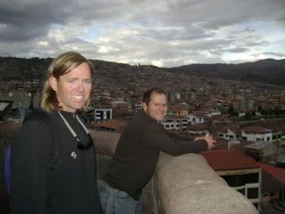
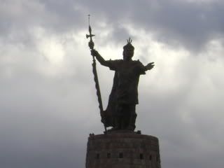
Cuzco is the ancient home of the Incas, and was settled in something like 1200 AD when a chief was ordered to go look for the belly of the Earth. It's set in a staggering valley and bordered by two rivers. The center of the city is sprawling cathedrals and a warren of winding alleys bordered by characteristic stacked rock Inca walls.

Photobucket

Much of the city has been unchanged for centuries, though of course now in the prettiest parts there are upscale restaurants and hotels.

Photobucket

Bill, Laura's brother, flew in from Atlanta via Lima at sunrise on Saturday.

Photobucket

We toured Cuzco on Saturday and today went to Pisac. Pisac is a tiny village high in the Andes empty Monday through Saturday and packed come Sunday with highlanders who come down to a very colorful market. Oh, and the several thousand tourists who come by bus at about 10:30. We left the crowds and hiked up to Pisac's Incan ruins. Mostly, the ruins are an extensive system of terraces etched into nearly vertical rock walls. It's quite a sight, and quite a quad workout to make it to the top, where the remains of a modest village hangs on to a small saddle.

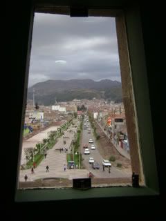
We'll be in ruins of one sort or another for the next week. Tomorrow we take the train to Machu Picchu -- exciting! Except for the cost of the train ticket. Not exciting! Anyway, until there, here's one more photo of Cuzco.

Photobucket

Sunday, October 12, 2008

Arequipa

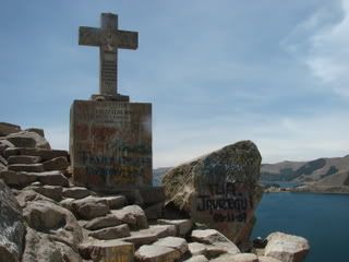
Copacabana, on the shores on Lake Titicaca, proved to be a very relaxing and cheap place to stay. Without intending to, we spent a week there taking walks along the lake, reading, drinking Bolivian coffee and eating Mexican food (yes, Mexican).
Photobucket


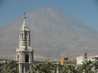
But all that free time gave me a lot of time to read the guidebook and a lot of time to start feeling guilty about not seeing more, so on Thursday we shoved off. We had a very easy border crossing into Peru and changed buses in Puno. We arrived in Arequipa just as the sun set -- a spectacular arrival, with the city glistening white under alpenglow and a line of 18,000 foot volcanoes, one of which puffs smoke occasionally, guarding the western horizon.

Photobucket

Arequipa is a beautiful if frenetic city. Much of the old city´s buildings are mde from distinctive white volcanic rock, and there are loads of old buildings and churches.

We spent two nights there and took a bus for Mollende, a beachtown 90 miles and 8,000 vertical feet away. Today we woke on the early side and went to Laguna Mejia, a national reserve about halfhour to the south. The reserve is a chain of lakes which is the only significant fresh water in a 1000 mile stretch of desert coast. The place is full of birds and despite the proximity to the equator is comfortably cool, thanks to the Humbolt Current. We walked down the chain of lakes and back on the beach, where men were out in the frigid water fishing for mussels and clams with nets. Tonight we´re going to have Pisco sours and ceviche and, of course, Inca Kola, the supersweet bubblegum soda which are are currently addicted to.

Wednesday, October 8, 2008

Loose Ends

Finished two books recently:

Joe Coomer´s The Loop. So so.

Saira Shah´s The Storyteller´s Daughter. Miserable, and full of lies.

Doris Lessing´s Winter in July. Wonderful.

Beer reports:

Potosina Pilsener: Watery Bolivian brew.

Huari Pilsener: Not quite as watery, bouyed by a great label.

Arequipena: A notch above the rest.

Cuscuna Stout: Dark, sweet Peruvian treat.


And a wine update:

Undurraga Cabernet-Pinot 2007 Valle Centra. A pleasant surprise. Got a halfbottle for $4 in San Pedro de Atacama.

Friday, October 3, 2008

Potosi

Our happiness at returning to civilization in Uyuni was tampered somewhat when we realized it actually was not civilization at all.

Took a bumpy ride from Uyuni to Potosi, a UNESCO world heritage site and reportedly the world´s highest metropolis (100,000 people) at 13,000 feet. Potosi was a major silver producing center and singlehandedly kept Spain´s coffers brimming for a few hundred years. Today it´s not as rich but still richly fascinating.

We spent a day doing Internet, getting laundry cleaned (what´s that smell? oh, I think they use kerosene) and walking the fascinating market and church squares. We stayed in a rambling mansion sort of place, up in a turret, which was buffetted by mountain winds all night. In the early evening there was shooting and I ran down to ask the hotel clerk if it was the revolution, and he said, Oh no, not in Potosi.

Early the next morning we took a six hour ride to Oruro. Oruro is nothing and certainly not scenic but the ride to La Paz was 8 hours and we did not want to risk a late arrival. The journey was marked mostly by a trail of bodies freshly killed in rather horrific single car accidents. The air felt empty over the bodies.

We checked into the nicest place we could find in Oruro. A truly disgusting place though I´ll never tire of markets like that town´s -- sprawling, with everything under the sun for sale.

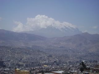
Took a morning ride to La Paz, the route traced by staggering volcanoes. La Paz comes as a surprise ... you don´t see it until you are looking down on it. It falls spectacularly from 13,500 feet to 12,500 feet, the buildings hanging onto steep canyon walls and a ginormous volcano looming beyond it.


Photobucket
We took a taxi across town (only our second taxi ride of the trip) to a smaller bus area and took a minibus to Copacabana -- not, not THAT Copacabana but another one. Very quiet, very cheap, and only 8 miles from Peru.

We´re assessing our next stage at this point.